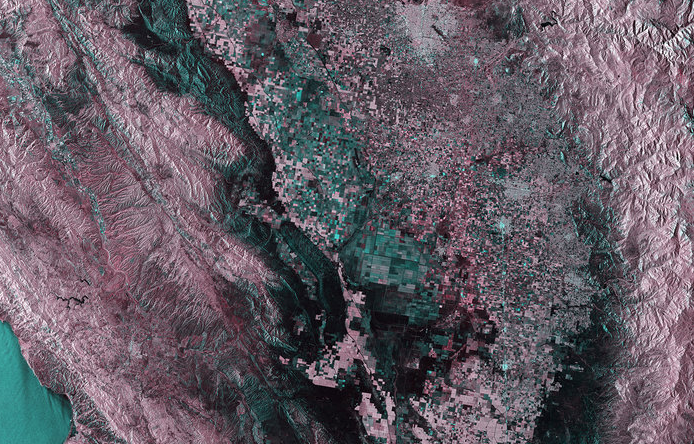
 "This image captured by Sentinel-1A’s radar on 1 April 2015 shows a central region of California in the US. The San Andreas Fault – the border between two tectonic plates – is visible as a somewhat straight line running from the upper-left corner of the image to the bottom centre. The Pacific Plate to the west is moving in a northwest direction, while the North American plate to the east is shifting southeast. This horizontal scraping is happening at up to about 5 cm a year in some parts of the fault..." Read on @ ESA Comments are closed.
|
Shared ThoughtsTogether, as learners in the education space, we would like to share a selection of what we read and reflect on internally. Categories
All
Archives
January 2016
|
 RSS Feed

|
Milpitas Unified School District
|
|